A new project for measurements onboard Boeing 787
A new project to modify Boeing 787 aircraft has started in February 2021. We plan to develop new CME and ASE instruments and install them into 787 aircrafts operated by Japan Airlines. The coming observations provided by 787 flights will strongly sustain the current CONTRAIL observation network.

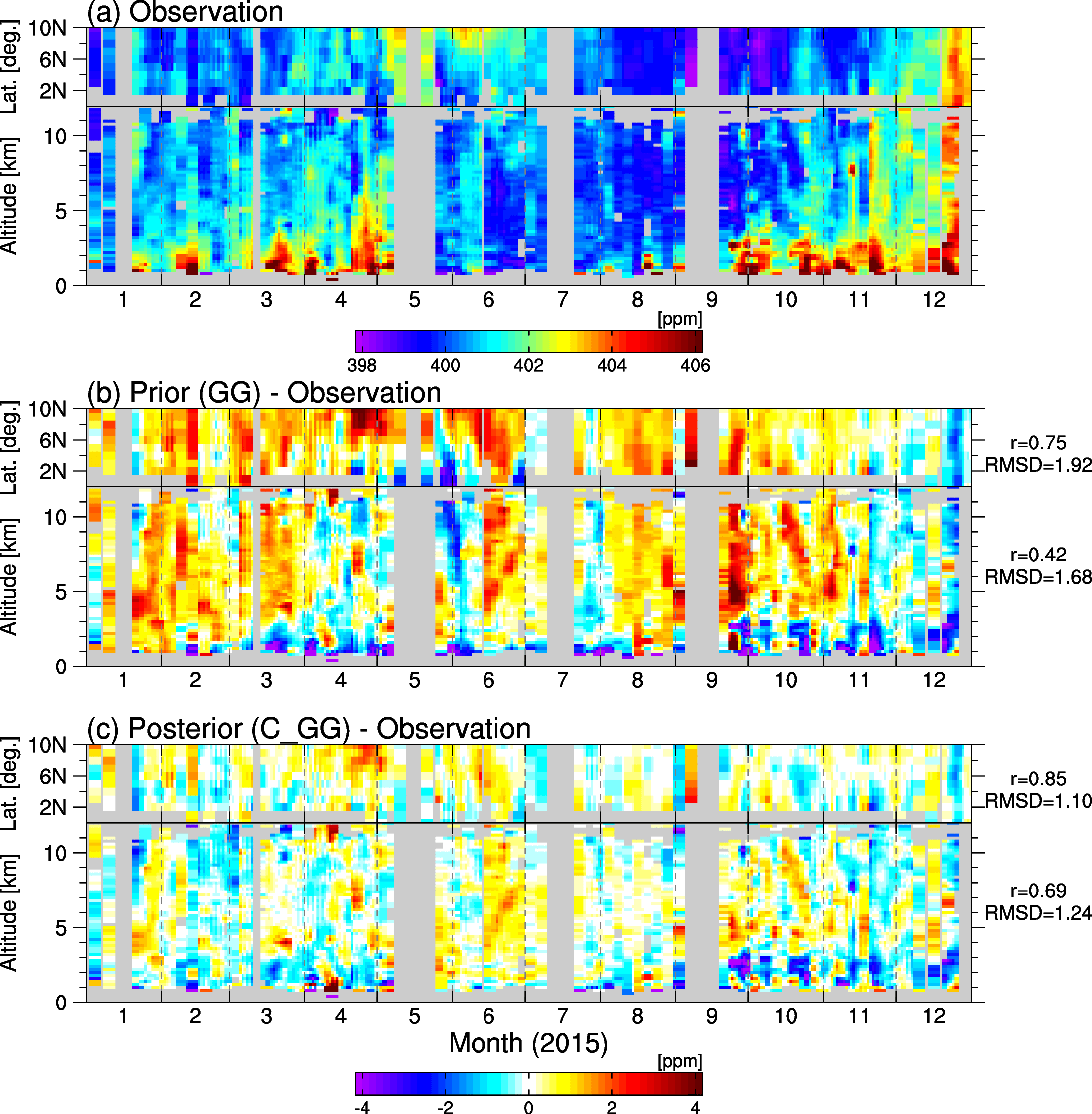
Estimation of fire-induced carbon emission from Equatorial Asia in 2015
The inverse analysis was used to estimate the fire carbon emission in Equatorial Asia induced by the big El Niño in 2015. This inverse analysis is unique because it extensively used high-precision atmospheric mole fraction data of carbon dioxide (CO2) from the commercial aircraft observation project. By comparisons with independent shipboard observations, especially carbon monoxide (CO) data, the validity of the estimated fire-induced carbon emission was elucidated. The best estimate, which used both aircraft and shipboard CO2 observations, indicated 273 Tg C for fire emission during September–October 2015. This two-month-long emission accounts for 75 % of the annual total fire emission and 45 % of the annual total net carbon flux within the region, indicating that fire emission is a dominant driving force of interannual variations of carbon fluxes in Equatorial Asia. Several sensitivity experiments demonstrated that aircraft observations could measure fire signals, though they showed a certain degree of sensitivity to prior fire-emission data. The inversions coherently estimated smaller fire emissions than the priors, partially because of the small contribution of peatland fires, indicated by enhancement ratios of CO and CO2 observed by the ship. In the future warmer climate condition, Equatorial Asia would experience more severe droughts and have risks for releasing a large amount of carbon into the atmosphere. Therefore, the continuation of aircraft and shipboard observations is fruitful for reliable monitoring of carbon fluxes in Equatorial Asia.