

Tadanobu Nakayama1)
1) Regional Environment Conservation Division, National Institute for Environmental Studies (NIES)
Tadanobu Nakayama1)
This monograph (Part VI, CGER-I167-2023) succeeds a series of the author’s previous reports: Vol. 11 (Part I, CGER-I063-2006), Vol. 14 (Part II, CGER-I083-2008), Vol. 18 (Part III, CGER-I103-2012), Vol. 20 (Part IV, CGER-I114-2014), and Vol. 26 (Part V, CGER-I148-2019) published before.
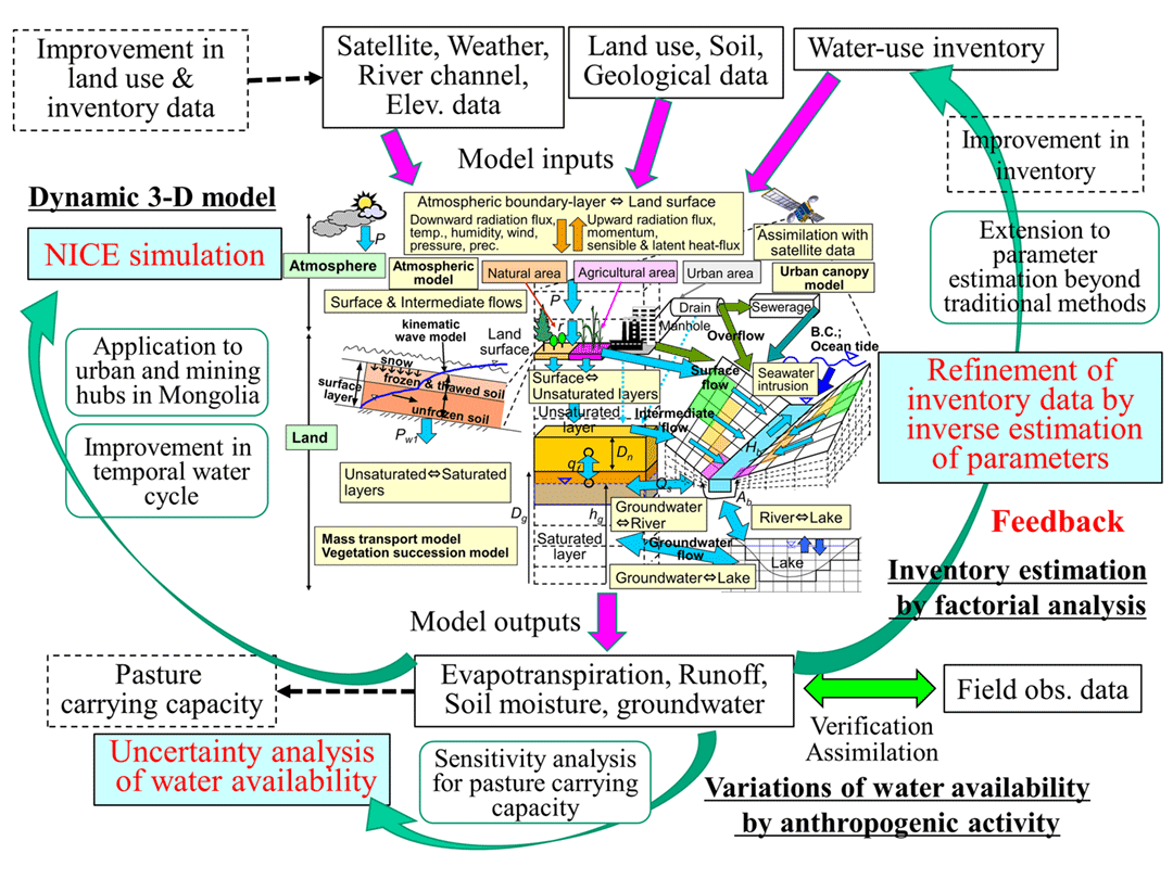
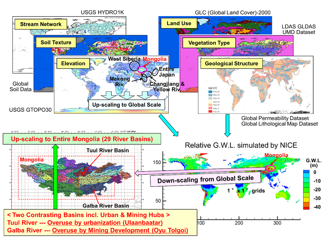
The National Integrated Catchment-based Eco-hydrology (NICE) is a 3-D, grid-based eco-hydrology model, and includes complex subsystems in natural vegetation, irrigation, urban water usage, stream junctions, and dams/canals, to develop integrated human and natural systems and to analyze the impact of anthropogenic activity on eco-hydrologic change. In addition to water cycle, NICE is capable of simulating heat, sediment, nutrients, carbon cycles, and associated vegetation succession, and has recently been expanded to include plastic cycle. The author has so far conducted simulations using NICE in various basins from regional to global scales (from Kushiro Wetlands, Tokyo metropolitan area, and Lake Kasumigaura to 109 first-class river basins in the entire Japan, as well as Yangtze and Yellow Rivers, Mekong River, Siberian Wetlands, and Mongolia to major global river basins). He developed natural-human systems in the model, and analyzed the effects of human activities on ecosystem changes there.
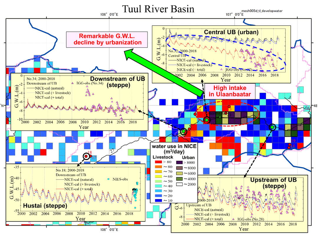
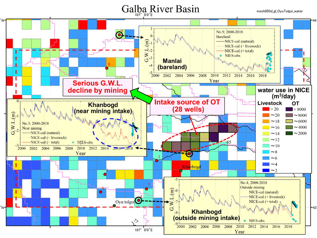
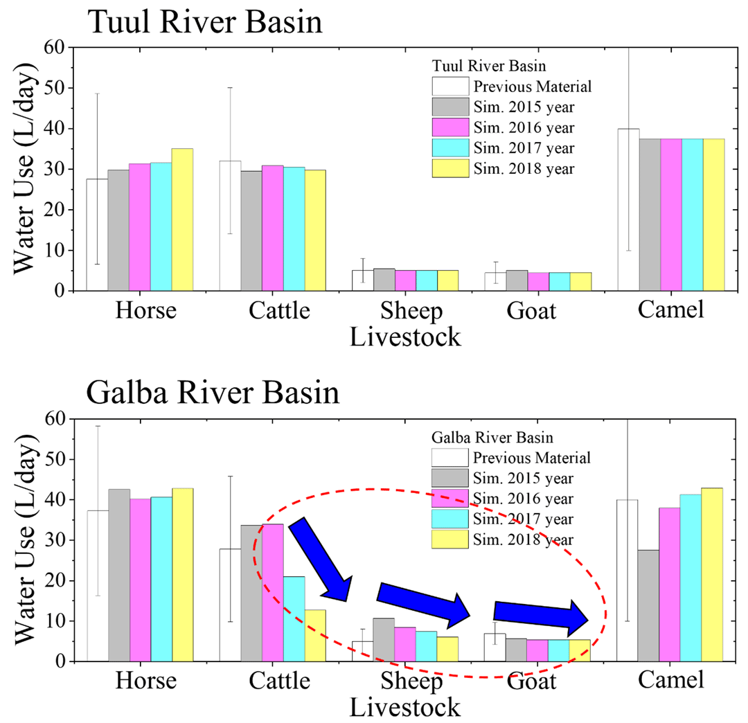
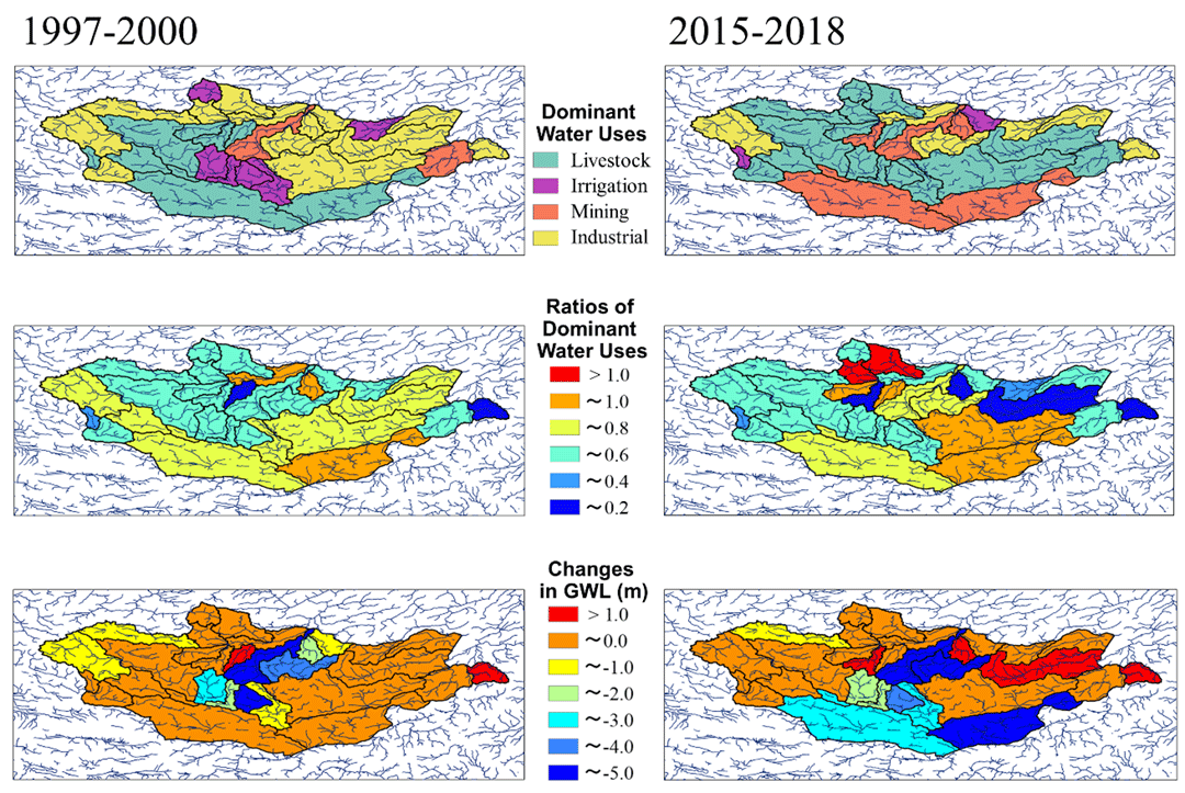
In the current monograph (Part VI), the author developed a new model, NICE-INVERSE, which couples NICE and the inverse model, targeting Mongolia with rapid economic growth but severe environmental degradation (Fig. 1). He introduces the results of evaluating the impact of human activities on the alteration of water resources from basin to national scales through sensitivity analysis and uncertainty assessment (Fig. 2). NICE quantified the effects of past climatic change and human-induced disturbances in the urban and economic hub, Ulaanbaatar, and the Southern Gobi mining hub on water resources there (Fig. 3). He also evaluated the changes in the water cycle due to rapid urbanization and mining development in these basins by analyzing the sensitivity of parameters and inversely estimating spatiotemporal fluctuations in livestock water consumption (Fig. 4). This suggesting a substantial increase in water stress due to local-regional eco-hydrological degradation by urbanization and mining. Further, the model was extended to scale up to the total of 29 river basins in the entire Mongolia, and analyzed relative contribution of environmental factors on the degradation of water resources on the national scale (Fig. 5).
This methodology introduced in this monograph is powerful for evaluating spatio-temporal variations of water availability towards effective utilization of water resources in regions with fewer inventory data like Mongolia, which the author targeted this time. It is also powerful to predict and resolve future competition for water resources that could potentially trigger conflicts between urban, mining companies, herders and local communities.
 PDF, 4.7 MB