Recent Research Results Development of an algorithm to retrieve aerosol optical properties over water for GOSAT-2/CAI-2
Aerosols are one of the largest uncertainty factors in estimations and interpretations of the Earth’s changing energy budget. They exert significant and complex impacts on the radiation process through both direct and indirect effects. Due to the limitation of spatial and temporal coverage from ground-based measurements, satellite remote sensing has been the most efficient approach to observe the variation of aerosols over wide areas and with fine spatial-temporal resolution.
In this study, we developed a fast yet flexible remote sensing algorithm to estimate the aerosol optical properties over water for the GOSAT-2/CAI-2. The algorithm uses the optimal estimation approach to simultaneously retrieve aerosol and water substances (SIRAW), combined with an artificial neural network (ANN) solver to perform the radiative transfer calculation. The ANN was well constructed based on an improved learning scheme and educated from a coupled atmosphere-ocean vector radiative transfer (RT) model over both open and coastal water.
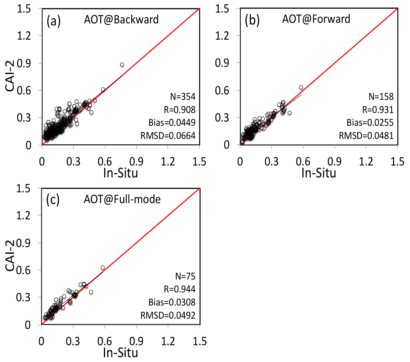
The main feature of SIRAW is that it can retrieve aerosol (fine, coarse, and absorptive soot) and oceanic particle information by considering the radiation process in the coupled atmosphere-ocean system and balancing the calculation efficiency via the ANN-RT scheme. To investigate the availability of SIRAW, the retrieval was conducted using the real CAI-2 data and preliminarily validated via the ground-based observation of Aerosol Robotic Network (AERONET) and Maritime Aerosol Network (MAN) over different ocean regions. Results demonstrated that the retrieved aerosol optical thickness at 550 nm (AOT) from CAI-2 had a good consistency to the in-situ measurement (Fig.1).
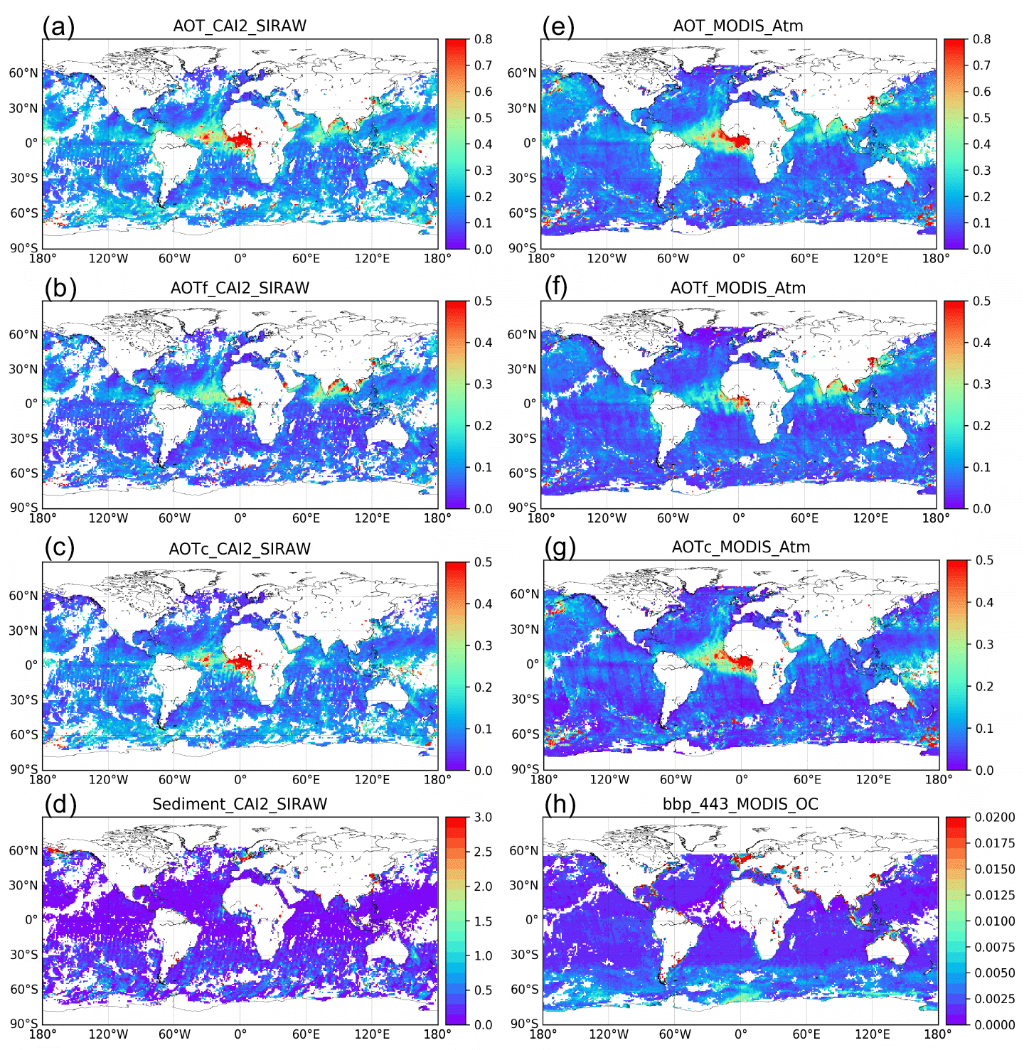
The algorithm developed by this study performed generally well for the AOTs and oceanic suspended particles over the global ocean through the inter-comparison to those of MODIS products (Fig.2). Moreover, the ultraviolet channel of CAI-2, which produces the first application with 500 meters spatial resolution, shows a promising skill in the monitoring of the smoke plume.
Future work will consider more aerosol models and aerosol layer height in the next version of SIRAW. Besides, the vicarious calibration of CAI-2 and retrieval based on the optimized combination of CAI-2 channels will also be conducted to provide a more accurate estimation of aerosols over the land and ocean.


