


A number of problems related to water are coming to the fore as the human population increases, industry develops, lifestyles change, and irrigated areas expand. Representative water-related problems are water shortages, groundwater depletion and ground subsidence from overuse, disruption of ecosystems from dams and reservoirs, health hazards from lack of safe water supplies and sanitation facilities, and in recent years water damage from more frequent heavy rainfalls and massive floods. In order to address these water-related problems, we must consider not only natural factors related to climate, geography, and soil but also socioeconomic factors such as irrigation, dams, polluted drainage, infrastructure development. Furthermore, it is necessary to consider competition for water resources between upper and lower river reaches and a large amount of water traded across drainage basin boundaries and international borders. Studies and analyses which integrated from drainage basin scale to global as well as from natural science to sociology are required, and managements and policies based on those studies and analyses are prerequisite.
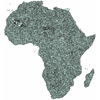
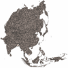
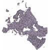
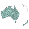
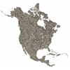
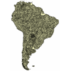
Given this background, the Center for Global Environmental Research at the National Institute for Environmental Studies has developed a Global Drainage Basin Database (GDBD) as one part of its database project. The GDBD is a database made up of six GIS data collections (drainage basin boundary data, river network data, discharge gauging station data, natural lake data, dam lake data, and flow direction data) that store a wide range of information on natural and social sciences. The GDBD provides basic information to a variety of water-related fields, and shows promise as a useful research and analysis tool for resolving water problems.
Reference : Yuji Masutomi, Yusuke Inui, Kiyoshi Takahashi and Yuzuru Matsuoka, Development of highly accurate global polygonal drainage basin data, Hydrological Processes, 23, 572-584, DOI: 10.1002/hyp.7186, 2009
| Terms and Conditions of Use (Read before downloading data. PDF: 30KB) | ||||||
| Instructions (PDF: 3.21MB) | ||||||
| Data
Format Unzip the downloaded file (with compression software that can handle zip files) to get the mdb (Microsoft Access Database) file. The file is in ArcGIS Geodatabase (Version 9) format and can be viewed with ArcGIS. The attribute data can also be viewed with Microsoft Access.
|
| March 17, 2009 | A reference paper was added. |
| July 11, 2007 | IDB files are added to each continental file. IDB files are needed to browse raster data. Instructions and Terms and conditions of use are updated. |
| May 29, 2007 | Released Version 1.0 |
Kiyoshi TAKAHASHI
![]()